
世界上最混乱的8个陆地边界
世界上最混乱的8个陆地边界
Do you think the world is a perfect jigsaw made of borders? The list of the 8 weirdest borders in the world in this article will make you think again.
你认为世界是由边界组成的完美拼图吗?这篇文章中列出的8个世界上最奇怪的边界会让你重新思考。
Boundaries are sometimes difficult and confusing questions. Due to historical problems, many strange borders have been formed. If you just look at the photos, you will see nothing remarkable, but the reality is different. Here are some of the strangest borders in the world, promising to intrigue anyone.
界限有时是困难和令人困惑的问题。由于历史问题,形成了许多奇怪的边界。如果你只是看照片,你会看到什么不寻常的,但现实是不同的。这里有一些世界上最奇怪的边界,保证会引起任何人的兴趣。
1. Diomede Islands, Bering Strait, North Pacific
北太平洋白令海峡戴奥米德群岛
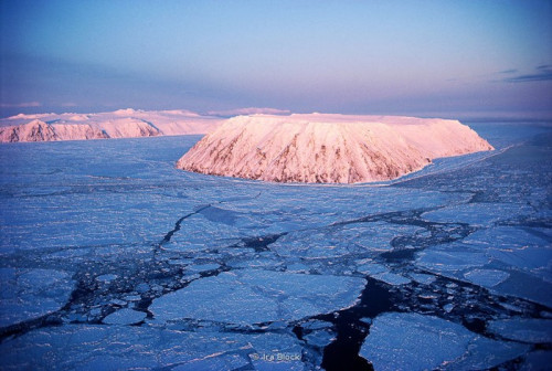
Located in the remote area of the Bering Strait between the easternmost tip of Siberia and the westernmost tip of Alaska (USA), the Diomede Islands are made up of two interesting islands: the Russian Big Diomede and the American Little Diomede.
戴奥米德群岛位于西伯利亚最东端和阿拉斯加(美国)最西端之间的白令海峡的偏远地区,由两个有趣的岛屿组成:俄罗斯的大戴奥米德岛和美国的小戴奥米德岛。
With the narrow water strip, the two islands are separated by the International Date Line, the imaginary line used to make the boundary between the time zone UTC + 14 and UTC-12 (near the meridian 180 degrees east from Arctic, across the Bering Strait).
由于狭长的水带,这两个岛屿被国际日期线分隔开来。国际日期线是时区UTC + 14和UTC-12之间的假想分界线(从北极往东180度,穿越白令海峡,接近子午线)。
2. Point Roberts: A strange border between Canada and the United States
罗伯茨角:加拿大和美国之间的一条奇怪的边界
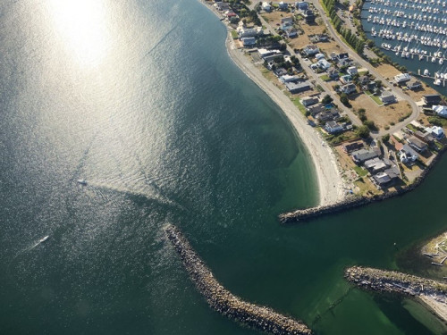
A dumb mistake made by 19th-century British and American politicians trying to draw the US-Canada border caused the Tsawwassen peninsula in Canada to give to Americans even though they were not even an inch apart.
19世纪英国和美国的政客们在试图划定美加边界时犯了一个愚蠢的错误,导致加拿大的察瓦森半岛给了美国人,尽管他们之间的距离甚至不到一英寸。
Today, this strange border is called Point Roberts. Anyone among the Point Roberts 1,000 residents who wants to go anywhere else in their country must go through Canada.
今天,这条奇怪的边界被称为罗伯茨角。罗伯茨岬角的1000名居民中,任何想去本国其他地方的人都必须经过加拿大。
3. Baarle: A confusing border between the Netherlands and Belgium
巴勒:荷兰和比利时之间令人困惑的边界
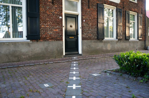
Walking through the sad town of Baarle is nothing special. But if you look at the map you'll see a scattered patch of seemingly random plots in town.
走过伤心的巴勒镇没什么特别的。但如果你看一下地图,你会看到城镇中一些看似随机的零散地块。
The turmoil originated from the noble families in the Middle Ages. So, in the 21st century, we still see a strange border: running through cafes, schools and even bedrooms. That means, a couple can be lying side by side and they are in two different countries!
这场动乱起源于中世纪的贵族家庭。所以,在21世纪,我们仍然看到一条奇怪的边界:跑步穿过咖啡馆、学校甚至卧室。这意味着,一对夫妇可以并排躺在一起,他们是在两个不同的国家!
4. Kaliningrad: The "unfortunate child" separated from Russia
加里宁格勒:“不幸的孩子”脱离了俄罗斯
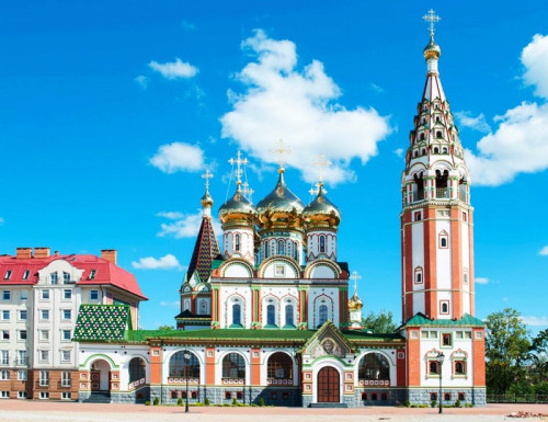
Do you think Russia is only made up of a giant frozen land in eastern Europe and northern China? A closer look at the European map shows a small "parcel of land" about the size of Wales between Poland and Lithuania.
你认为俄罗斯只是由东欧和中国北部的一块巨大的冰原组成的吗?仔细看一下欧洲地图,就会发现在波兰和立陶宛之间有一块面积相当于威尔士的“一小块土地”。
5. Märket Island: A strange border between Sweden and Finland
市场岛:瑞典和芬兰之间的奇怪边界
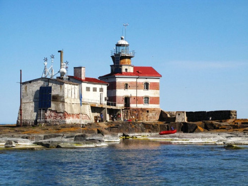
Located in the Baltic Sea between Sweden and Finland, Märket Island is the smallest sea island in the world shared by both countries. The true funny story began in 1885, when the Russian Empire (ruling Finland at that time) built a lighthouse on the Swedish side by mistake.
市场岛位于瑞典和芬兰之间的波罗的海,是世界上两国共有的最小的海岛。真正有趣的故事开始于1885年,俄国帝国(当时统治芬兰)错误地在瑞典一侧建造了一座灯塔。
6. Ceuta: A strange border between Spain and Morocco
休达:西班牙和摩洛哥之间的奇怪边界
After centuries of passage between different kingdoms and dynasties, the port city of Ceuta of North Africa has been Spanish possession since 1668.
经过几个世纪在不同王国和王朝之间的往来,北非的港口城市休达自1668年以来一直是西班牙的属地。
7. Derby Line: Another strange border between the US and Canada
德比线:美国和加拿大之间的另一条奇怪边界
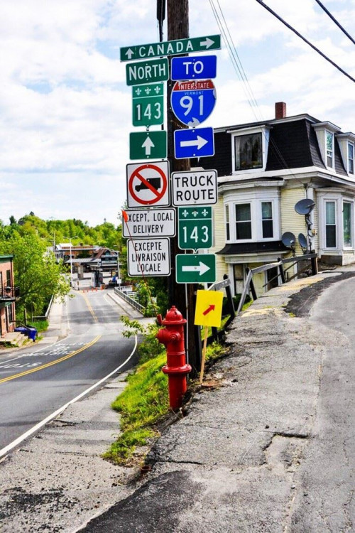
Is this America's friendliest border? Both the small towns of Derby Line and Stanstead in northern Vermont have a hilariously named Canusa Boulevard, where American and Canadian homes are directly facing each other and international borders creep through the neighborhoods, garden and cafe.
这是美国最友好的边境吗?佛蒙特州北部的德比线和斯坦斯特德这两个小镇都有一个滑稽的名字——加努萨大道。在这里,美国和加拿大的房屋正对着彼此,国际边界蜿蜒穿过社区,花园和咖啡馆。
8. Gambia (West Africa)
冈比亚(西非)
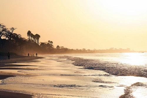
As the smallest country in Africa, Gambia is hard to see on the map. With its short, narrow coastline along the Gambia River, it is like a finger poking into Senegal's body.
作为非洲最小的国家,冈比亚在地图上很难被看到。它沿着冈比亚河有着短小狭窄的海岸线,就像戳进塞内加尔身体的一根手指。


- 频道推荐
- |
- 全站推荐
- 推荐下载
- 网站推荐


